
Occurrences & maps
Observation records, importing occurrences, distribution maps and the interactive map.
Occurrences are observation records: where and when a species was recorded. From them the app makes distribution maps for information pages and an interactive map for exploring.
The Occurrences tab#
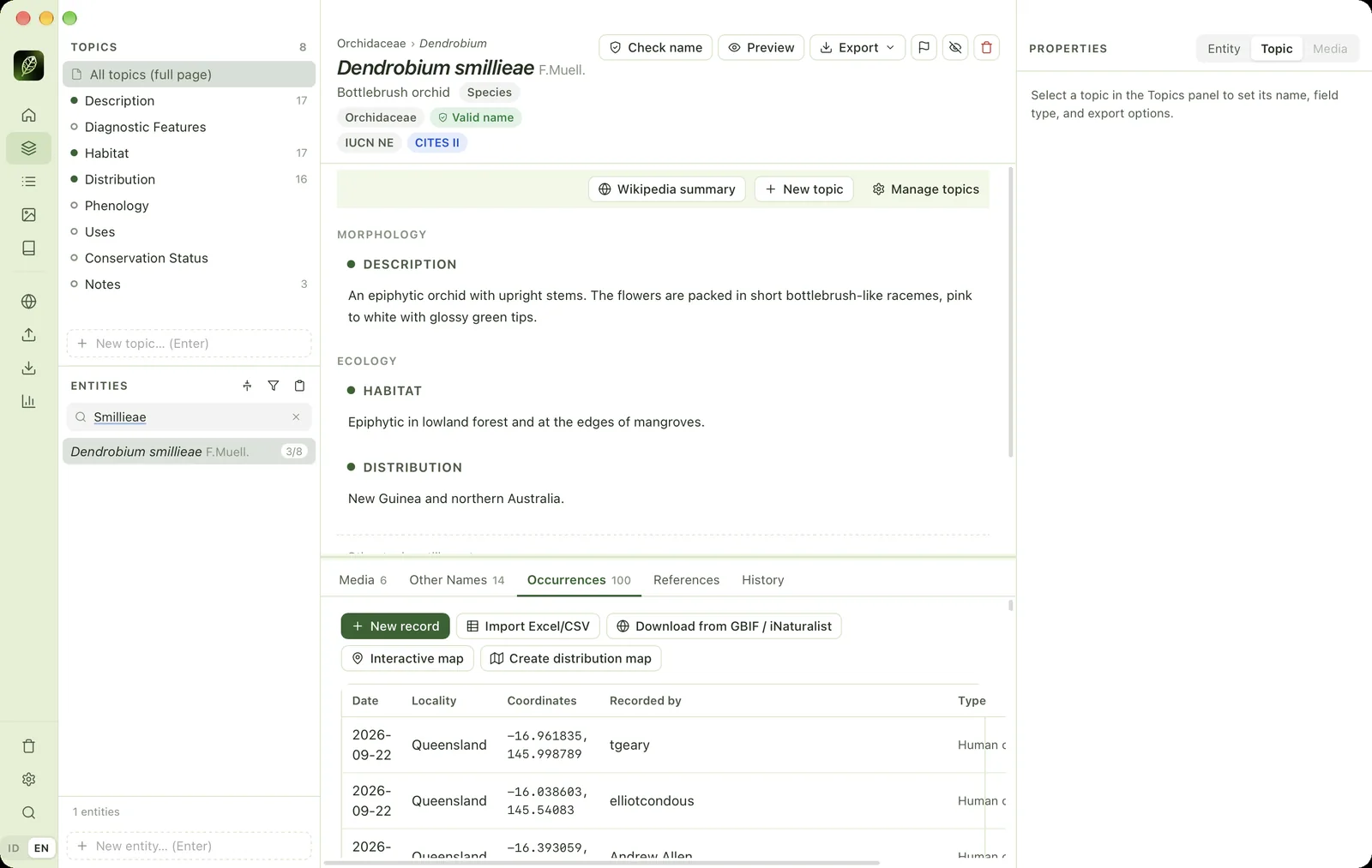
- 1Occurrences tabNumber = how many records this entity has.
- 2New recordAdds a single observation record by hand.
- 3Import Excel/CSVImports records for this entity from a table.
- 4Download from GBIF / iNaturalistFetches georeferenced records from GBIF and iNaturalist.
- 5Interactive mapOpens the occurrence map for this entity.
- 6Record tableDate, locality, coordinates, recorder and record type.
- 7Wikipedia summaryIn the full-page view: inserts a Wikipedia summary with its attribution.
New record has fields for date, locality, province, country code, decimal latitude/longitude, recorded by, catalogue number, record type and notes. The pencil icon on each row edits it, the trash icon deletes it.
Importing occurrences for many species#
Open Import → Occurrences (Excel / CSV). Darwin Core, English and Indonesian column names are recognised automatically. Coordinates may be decimal or DMS (N/S/E/W, or Indonesian LS/BT). Each row is matched to an entity by scientific name or synonym. Names that are not found are skipped and reported with spelling suggestions. Coordinates of 0,0 are treated as missing, and duplicate records are not imported again.
Distribution maps#
Create distribution map draws the occurrence points over TDWG WGSRPD level 3 botanical regions or country borders (Natural Earth), with latitude–longitude lines and source attribution. The map is saved as a picture in the entity's media folder, so it appears on the information page automatically. For many entities, use bulk actions.
Interactive map#
Open Web Services → Occurrence map, or click Interactive map in the Occurrences tab.
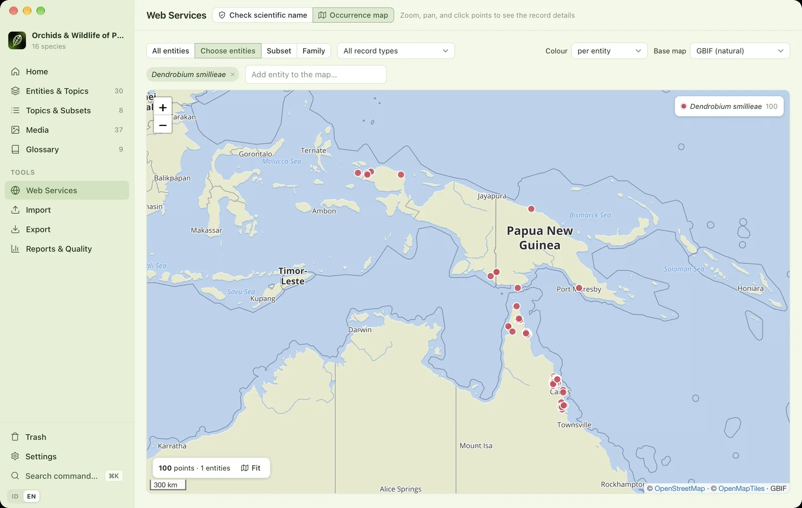
- 1ScopeAll entities, chosen entities, one subset or one family.
- 2Record typeFilter by type: observation, specimen and so on.
- 3Point colourColour by entity or by record type.
- 4Base mapGBIF, OpenStreetMap (needs internet) or offline (country borders).
- 5Entities on the mapAdd or remove the entities shown.
- 6Zoom+/− buttons, scrolling or double-clicking.
- 7LegendColour and number of points per entity.
- 8Occurrence pointsClick to see the record.
- 9Count & FitNumber of points shown. Fit = fit the map to all points.
- 10AttributionThe base map source, which must be shown.
Click a point to see its record: entity name, date, locality, coordinates, recorded by, catalogue number, record type and source. Records from GBIF or iNaturalist link to their original page. When several points overlap, use the ‹ › buttons to move between them. The open-entity button opens that entity in the workspace.
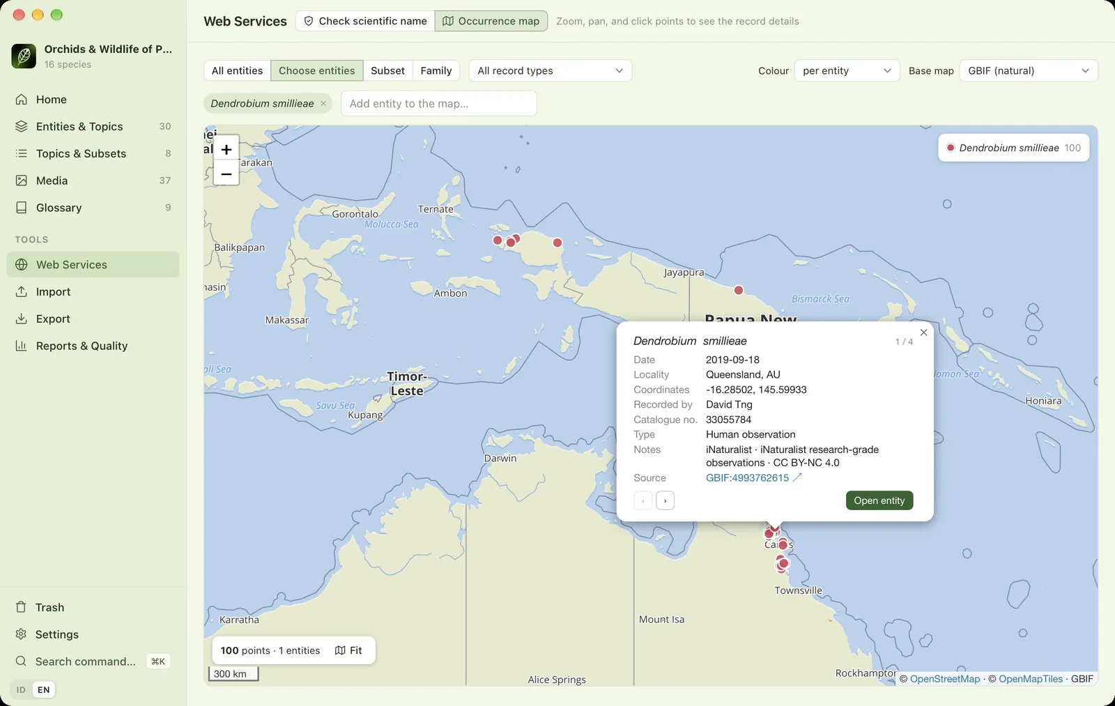
Only records with a latitude and longitude are shown. The number of records without coordinates is shown below the map. The Offline (country borders) base map works without internet.
Checking occurrence quality#
Before publishing maps, check suspicious points in Reports & Quality → Occurrence quality.